Similar Projects | All Projects for Client
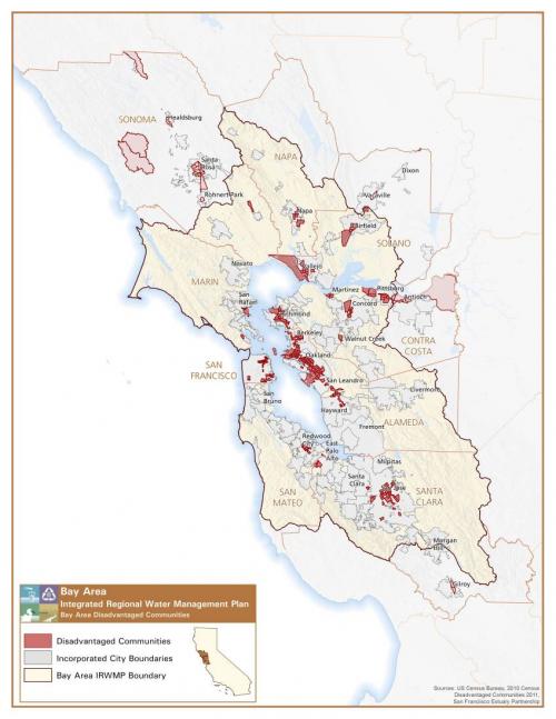
The Bay Area Integrated Regional Water Management Plan is a nine-county effort to coordinate and improve water supply reliability, protect water quality, manage flood protection, maintain public health standards, protect habitat and watershed resources, and enhance the overall health of the bay. Kearns and West, a consulting firm working on the plan, looked to GreenInfo to develop maps showing the region's demography.
GreenInfo created a series of maps to show disadvantaged communities and minority populations (based on 2010 census data) in relation to flood plains within the Bay Area Integrated Regional Water Management Plan boundary. Serving the storm water management needs of low-income, disadvantaged communities is a high priority for the water agencies and for the non-profit organizations who are working with them in developing the Bay Area Integrated Regional Watershed Management Plan (IRWMP).
Focus: Environment, Social Justice/Equity
Services: GIS Services, Data, Maps
Tags: census 2010, demographics, Esri ArcGIS, integrated regional water management plan, IRWMP
Project Years: 2010