Similar Projects | All Projects for Client
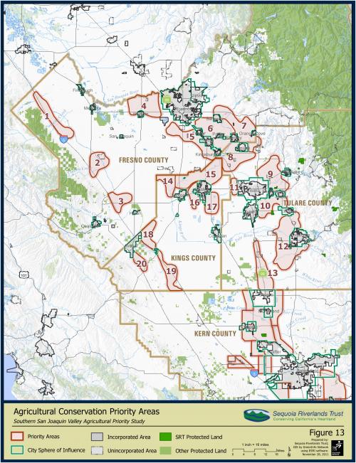
Tom Scharfenberger and Sequoia Riverlands Trust are consistent believers that GIS an maps help in conservation planning and getting the message across. GreenInfo helped develop a series of maps to supplement the Southern San Joaquin Valley Agricultural Priority Study.
GreenInfo has a long history with both Tom Scharfenberger and the Sequoia Riverlands Trust. From conservation easement baseline monitoring mapping to full conservation plans the use of GIS has helped conservation efforts in the Central Valley. The Southern San Joaquin Valley Agricultural Priority Study included developing 13 mapping Figures, ranging from Crop Type and Water Districts, to Regional Priorities and Floodplains. Using the maps as a guide, Scharfenberger and SRT determined Agricultural Priorities for the region.
Focus: Conservation
Services: GIS Services, Maps, Cartography
Tags: agriculture, California, Esri ArcGIS
Project Years: 2011