See This Project | Similar Projects | All Projects for Client
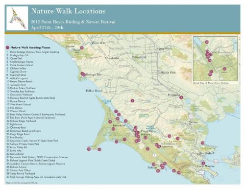
The annual birding festival around Point Reyes California attracts a large crowd. The sponsors needed a quick map to help guide participants to locations and asked GreenInfo for help.
GreenInfo created a base map in GIS that matched the look and feel of the Point Reyes Birding Festival logo. Working closely with the client, we geo-located and highlighted meeting points for the Nature Walk events. All told, a five hour project.
Results: For a few hours of GreenInfo work, the Birding Festival got a clear map to orient its users.
Focus: Environment
Services: GIS Services, Maps, Cartography
Tags: Birds, California, Esri ArcGIS
“ The map you created was gorgeous. It looks brilliant on our festival website and we used it as a handout that was extremely popular. ”
— Amaroq Weiss, 2011 Point Reyes Birding & Nature Festival Coordinator
Project Years: 2011, 2012