Similar Projects | All Projects for Client
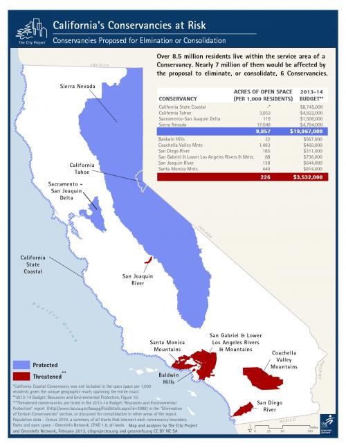
For a state as large as California, large distances can lead to challenges in understanding places. A legislative report suggested an action reducing support for some state land conservancies, but after mapping by GreenInfo, a distinct pattern emerged.
A report in the California Legislature on the 2013-14 budget for resources and environmental protection suggested slashing funding for many of California's public land conservancies (state agencies, not private land trusts). But the report did not illustrate with maps the fact that those slated for closure or consolidation were all in the highly dense region of southern California.
Groups supporting continuation of all of the conservancies approached GreenInfo to make a map showing the proposed reduction in funds, as related to the geography of each conservancy, to help them in making their case. The graphic helps to illustrate the facts of the report in one quick image cover budget, location, and proposed status.
Focus: Conservation, Environment
Services: GIS Services, Maps, Cartography
Tags: California, cartography, conservancy, Esri ArcGIS
Project Years: 2013