See This Project | Similar Projects | All Projects for Client
Getting younger people to parks and recreation is a big priority in California - use of larger natural areas is not growing and population changes and lifestyle trends have made this a more difficult challenge. As part of a major effort to overhaul California's state parks, a new web application was commissioned to help reach more people, especially those who rely on social media and smart phones, and GreenInfo was asked to enhance its statewide parks data as the foundation of the new application.
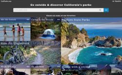
Stamen Design led the development of the web application, bringing in their expertise in connecting social media postings to parks - they had used GreenInfo's CPAD data earlier to pioneer harvesting Twitter, Instagram, Facebook, Flickr and other media feeds in order to show the social side of parks, not just their natural features. This idea is key to engaging a generation that strongly connects to that type of communication and engagement. They've written up the story of what they did on CaliParks.
You can follow the social media comments on CaliParks on Twitter, and you can track GreenInfo in those tweets! A good overview news article was published in March 2015 in New American Media.
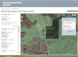
GreenInfo helped advise on the application early on and at points along its development, but our main role was fine-tuning and enhancing the core data that drives CaliParks, the California Protected Areas Database (CPAD) - learn more about this data at CALands.org.
We did the following:
1) Data - we reviewed large park agencies for updated data and adjusted CPAD generally for new additions.
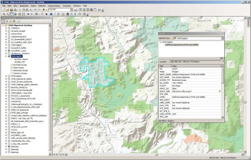
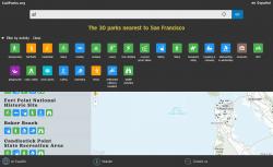
2) Large, key parks - with Stamen, we helped define 1,000 parks to enhance with more detailed data - these were generally those with 750+ acres, and especially with strong social media postings. We reviewed all 14,000 CPAD parks and filtered out those that did not have "Open" public access, then checked to confirm that our access codes were indeed accurate, which meant poring over agency web sites and other data for these 1,000 parks, eventually winnowing them down to about 900.
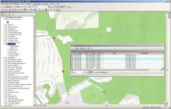
3) Entry points and URLs - for these focus parks, we researched the exact location of entry points and created GIS data for those locations - this data is essential in guiding visitors to an exact starting point, using phone navigation. Having the website for each park maintained by agencies was also crucial for providing users with detailed information, and we tracked these down as well.
4) Recreation activities - HipCamp was charged with coding the 900 key parks with major outdoor activity data (camping, hiking, riding, swimming, etc.), but GreenInfo was able to add more urban recreational activities for five thousand parks in cities. We used extremely accurate data we developed earlier for California Dept. of Parks and Recreation for 8 categories of recreation, including ball fields, playgrounds, skate parks, basketball courts, tennis courts, etc. - this helped the project have far more recreational activity data than just for the 900 large parks, as our data set has 13,000 points of recreation in about 5,000 urban parks. You can browse this recreational facilities data on one of our ParkInfo sites.
5) Data coordination - Finally, we worked with Stamen to define a process for allowing future updates of the CPAD GIS data to easily update the CaliParks data. The complex nature of CPAD's database structure and the challenges of linking it to another online database were considerable, but GreenInfo and Stamen staff figured out a solution. This new approach will also help us in our work on the Protected Areas Database of the U.S. (PAD-US), where we work with the USGS Gap Analysis Program. It will also inform our engagements on PAD-US with the National Park Service, the Centers for Disease Control and others.
CaliParks is a specialized application to connect social media and park location/activity information and we're been proud to be a partner in its development. Keeping up CPAD will be crucial to its long term success, as accurate park boundaries are the foundation for connecting social media and other information. GreenInfo will also continue developing its Parkinfo.org application, which focuses much more strongly on finding any type of park through a much more map-centric focus. There are many audiences for park-related information and it's unlikely that any one application will serve all needs. But having CaliParks in the mix now is a huge step forward for everyone who cares about parks and outdoor engagement!
Focus: Environment, Recreation, Social Justice/Equity
Services: Interactive Solutions, GIS Services, Data, Mobile Applications
Tags: California, CPAD, Esri ArcGIS, ParkInfo, parks, recreation
Project Years: 2014-15