Similar Projects | All Projects for Client
Getting people into one of the nation's most heavily used recreation areas is a key job of the Golden Gate National Parks Conservancy. When the Conservancy developed its new web site, they wanted a showcase mapping application to help them guide people to places in the parks, and asked GreenInfo to apply its skills to building it.
(Note: this web map is no longer active on the GGNPC site)
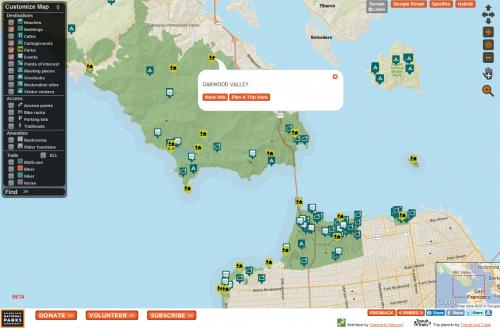
The Golden Gate National Parks Conservancy (GGNPC) engaged GreenInfo Network to build an application allowing visitors to their website to see a map of parks, park amenities, and park-related events, and to select and filter their choices. The web map GreenInfo developed integrates with the GGNPC website: the map appears embedded into the page and/or inside a popup, focused on the feature being described on the page. The result is visually effective, giving instant meaning and context - and it has a ton of functionality.
GGNPC wanted to see very large amounts of feature detail for this initial version of the map - as a result, users can turn on/off 20 layers of data.
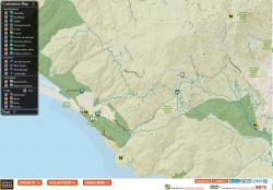
The web map includes trail heads and campgrounds (among many other features), and transit and driving directions, courtesy of Transit and Trails (www.transitandtrails.org). This allows the users to request directions to an event or location, by driving or by public transit. The base map in the application uses GreenInfo's ParkInfo mapping system, with its beautiful, custom base map and park boundary data (available for other applications, too).
A very interesting and technically challenging part of this project is that the park locations and events are stored on the GGNPC web server, and trail heads and campgrounds are stored on the Transit and Trails web server (while the ParkInfo tiles are stored in yet another). To display the data on the web map, GreenInfo designed a system to download feeds of data from the websites and convert them into a map-capable database. This project was truly a cross-platform cross-agency collaboration.
Results: The map was actively used over a one year period, but has since been superseded by a new routing system.
Focus: Environment
Services: Interactive Solutions, Web Mapping
Tags: California, GGNPC, parks, recreation, San Francisco, Transit and Trails
“ I want to recognize and thank GreenInfo again for your excellent instincts, communication, technical chops, and perspective that you applied in helping us achieve this goal of which we are so proud. ”
— Michael Norelli, GIS Manager
“ Thank You for everything you’ve done to make this site and map so beautiful. We had a lot of balls in the air here, but yours was usually the brightest: You were wonderful to work with.”
— Mark Pothier, Online Communications Director
Project Years: 2012