See This Project | Similar Projects | All Projects for Client
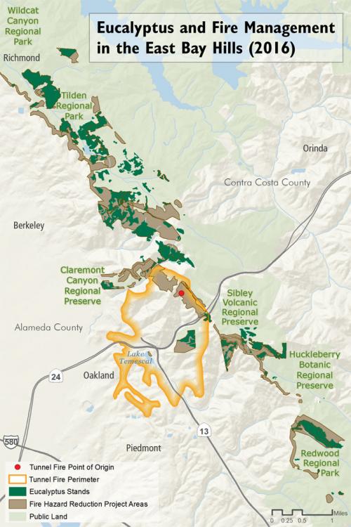
The 1991 Tunnel Fire in the Oakland Hills (California), which killed 25 people and
destroyed more than 3,000 homes, confirmed for many people what they had
long suspected: Eucalyptus trees are a hazard. Though the fire started in
grass, the trees were blamed for the severity of the disaster. Bay Nature magazine asked GreenInfo to research and develop a map illustrating the extent of Eucalyptus in the region.
This project is an example of how GreenInfo develops effective, accurate maps for very small cost. Total time required was six hours, including two hours of data research - the remainder was spent developing the cartography and refining the map in collaboration with Bay Nature.
Focus: Conservation, Environment
Services: GIS Services, Communications, Publications, Maps, Cartography
Tags: Esri ArcGIS
Project Years: 2016