See This Project | Similar Projects | All Projects for Client
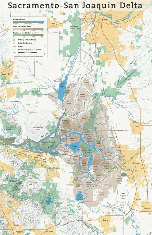
Bay Nature publishes an award-winning quarterly magazine and frequently asks GreenInfo to prepare centerfold maps on topics covered in the magazine. Showing the essential geography of California's endangered and valuable Delta region was the challenge for this project.
California's Delta region is the mixing point for the two major river systems in the state, the "heart" where waters converge and are transported to other destinations. For a special feature in Bay Nature magazine, GreenInfo was asked to develop an 11x17" map that illustrated key aspects of the Delta in a clear, yet authoritative way.
GreenInfo's Louis Jaffe and GIS staff assembled the needed spatial information, then used illustration software to render it in a form suitable for publication in the Bay Nature magazine.
Focus: Conservation, Environment
Services: GIS Services, Communications, Graphic Design, Data, Maps, Cartography
Tags: Bay Nature, California, Delta, Esri ArcGIS
Project Years: 2011