See This Project | Similar Projects | All Projects for Client
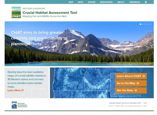
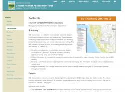
Critical habitat mapping is done by individual states - the Western Governors Association wanted to provide a portal that would unify all of this data in 13 western states, and enable government, conservation and development interests to all have easy access to generalized information about the value of particular lands as habitat.
GreenInfo was asked by its occasional partner, Applied Geographics, to lead the development of the overall web site design for the WGA Critical Habitat Assessment Tool (CHAT) project, with AppGeo managing the overall project and doing the major work on the data, mapping and actual site construction.
GreenInfo worked with WGA stakeholders and AppGeo to clarify users and expectations, including an all-day workshop and other input methods. We first created basic wireframes of key functions and tested those with WGA and key state participants, then worked with our frequent design partner, Ison Design, to develop the graphic layout for the overall site, including a logo.
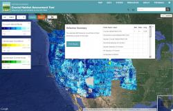
For the map function on the site, GreenInfo developed basic design options for a clean and simple layout, which guided AppGeo's work in building the full functionality called for in the design efforts above.
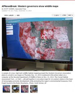
The site launched in December 2013 and received extensive press coverage. Its main targets are key staff and decision makers who need a one-stop approach to gaining a quick overview about the habitat values in any potential area of interest. The site lets users define a project area and get detailed information, and has direct connections to the more detailed state habitat sites. The management of the CHAT site was later transferred to the Western Association of Fish & Wildlife Agencies (WAFWA).
Focus: Conservation, Economic Development, Government Agencies
Services: Interactive Solutions, Website Design
Tags: CHAT, design, Google Maps API, habitat, responsive, Western United States
Project Years: 2013