See This Project | Similar Projects | All Projects for Client
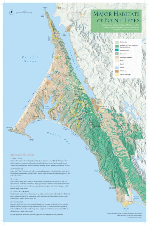
2012 marked the 50 anniversary of the establishment of the Pt. Reyes National Seashore, one of the most heavily visited units of the National Park Service. For a special publication on this event, Bay Nature asked GreenInfo to develop a detailed map of the "natural infrastructure" of the peninsula, focusing on habitat types.
This map was developed by Louis Jaffe, in coordination with GreenInfo staff. Detailed GIS data on vegetation types was refined and custom cartography then developed to showcase the information. The map uses special techniques to allow hillshading to show clearly but not to obscure the habitat data. For the Bay Nature supplement, a series of special hike routes were also defined on the map.
Focus: Conservation
Services: GIS Services, Communications, Publications, Maps, Cartography
Tags: California, Esri ArcGIS, habitat, Pt. Reyes
Project Years: 2012