See This Project | Similar Projects | All Projects for Client
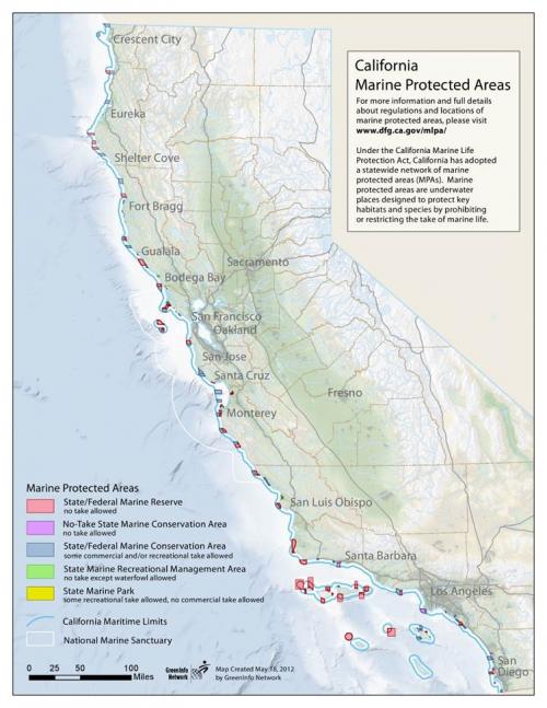
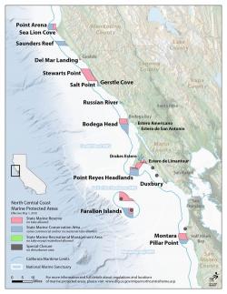
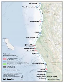
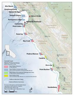
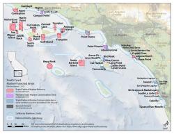
As part of the outreach efforts for the Marine Life Protection Act, GreenInfo worked closely with Ocean Conservancy to create simple maps of marine protected areas for education purposes and use by the media.
In an ongoing effort to inform the public about marine protected areas, these easy-to-read maps were an important piece in the outreach puzzle. General information about MPA locations and types are provided for a quick overview of protected areas along California's coast.
Focus: Conservation, Environment
Services: GIS Services, Maps
Tags: California, coast, Esri ArcGIS, fishing, Marine, Marine Protected Areas, MLPA, MPA, Ocean
Project Years: 2012