
See This Project | Similar Projects | All Projects for Client
Ecosystems flow across national boundaries. For a number of years, Canada, the U.S. and Mexico natural resource agencies have been working on collaboration strategies across the North American continent, to address conservation needs. GreenInfo was asked by USGS and the National Park Service to prepare a major presentation for the 2016 IUCN World Conservation Congress on the state of this collaborative work.
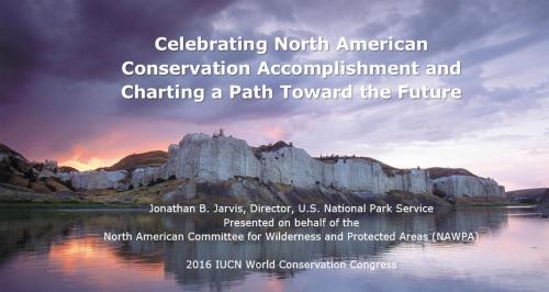
Due to its longstanding work with the USGS Gap Analysis Project (GAP) on the Protected Areas Database of the U. S. (PAD-US), GreenInfo was asked by USGS to work with it and the National Park Service to develop a major presentation for the NPS Director, Jonathan Jarvis, to deliver at the 2016 IUCN World Conservation Congress held in early September 2016 in Hawaii. The full presentation video is on YouTube (starts about half way through the full video).
The initial task in the project was working with a technical and leadership group to define overall approaches and messaging. GreenInfo reviewed the NAWPA report findings and engaged USGS and NPS staff in discussions to determine the key conclusions that would drive the presentation, and the overall approach to how they would be presented. In addition to an overall narrative, the group decided to also highlight three or four key examples of cross-border ecosystem conservation challenges and responses.
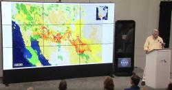
USGS staff worked on the details of the cases, developing GIS data and mapping that could best explain issues and opportunities in Glacier-Waterton National Park (Canada-U.S.), the desert borderlands (U.S.-Mexico), and the Gulf-Atlantic region for marine issues. GreenInfo staff assisted with advice on visualization, with the USGS GAP staff producing a series of well-designed map images for each case.
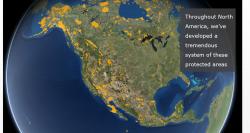
In addition to the USGS maps, GreenInfo worked with Esri's Story Maps team to develop a version of the presentation in that format, but also to create two 3-D "globe" maps of the North American protected areas landscape, which were placed into the PowerPoint as images, and as live interactive maps in the Story Map version. Read the project entry on this story map version »
Many rounds of design and revision were undertaken to build the overall presentation, which used a highly visual approach, with little text. However, detailed explanations were also created as speaker notes, to guide Director Jarvis' actual presentation. In total, approximately 50 slides were created, with careful animations and other effects.
The full 25 minute presentation was delivered in the U.S. Pavilion at the WCC conference. The audience attending included: Mexican Protected Areas Commission Alejandro del Maso Masa, U.S. Interior Secretary Sally Jewel, Council on Environmental Quality Managing Director Christy Goldfuss, US FWS Director Dan Ashe, USGS Associate Director Kevin Gallagher, Chief of the USFS Tom Tidwell, and Daniel Watson, Parks Canada Director.
Focus: Conservation, Government Agencies
Services: Communications, Presentations, Strategy
Tags: Esri ArcGIS, Esri Story Map
Project Years: 2016