See This Project | Similar Projects | All Projects for Client
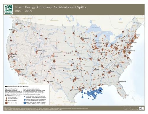
After the 2010 Gulf oil spill, the National Wildlife Federation asked GreenInfo to help depict the full range of fuel incidents in the U.S., including oil and gas.
GreenInfo staff researched and assembled the underlying data, working with NWF staff and developed a poster map showing a decade's worth of spills, with each dot sized to indicate the scale of the incident. The map contains extensive cartographic detail of all reported spills, including those in the the Gulf of Mexico.
Focus: Environment, Public Health
Services: GIS Services, Data, Maps, Cartography
Tags: Esri ArcGIS, oil spill, united states
Project Years: 2010