Similar Projects | All Projects for Client
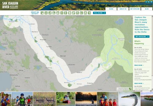
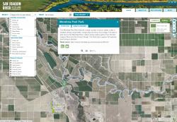
The San Joaquin river is the spine of California's southern Central Valley, flowing 300 miles from the Sierra to the San Francisco Bay. Despite major environmental challenges to the river's health, restoration efforts are making great progress in allowing anyone to enjoy fishing, hiking, camping and many other recreational activities by the river. To highlight these and provide better public information a partnership of groups working for the river asked GreenInfo to build an online access guide to using and enjoying the San Joaquin river.
Data work included supporting members of the partnership in their data gathering, and transforming that information to GIS data for the mapping application.
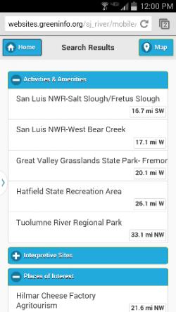
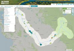
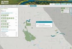
To develop the web application, GreenInfo started with the idea of a semi-live map as the home page, with direct links to a more functional map one click in. On the home page, users can hover over icons and see where recreation is, then go to the full guide for more details and special searches. Searches can be for parks, interpretive sites, or amenities. Clicking parks on the map offers travel directions and birds-eye photo views, plus a "what's nearby" tab.
The web site also includes a blog that the Partnership can post events to. This was done through a WordPress site that is pulled into the access guide site.
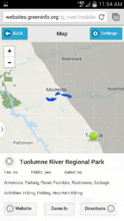
The web site was developed to work on a phone, without requiring the download of a mobile application - the site senses a mobile device and reformats itself to fit that type of device. These mobile users can quickly find recreation near them, and get directions to it.
The entire site was developed using open source tools and technologies, in particular Leaflet and Javascript.
Funding for the project was provided by the National Park Service Rivers, Trails, and Conservation Assistance Program, Resources Legacy Fund, The Nature Conservancy, The San Joaquin River Parkway and Conservation Trust, and member organizations of the San Joaquin River Partnership.
Focus: Environment, Recreation, Social Justice/Equity
Services: Interactive Solutions, GIS Services, Data, Applications Development, Web Mapping, Mobile Applications
Tags: parks, recreation, rivers, San Joaquin River
Project Years: 2014