See This Project | Similar Projects | All Projects for Client
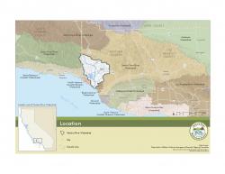
Working to protect the large watershed surrounding the Ojai Valley in California's Central Coast, a land conservancy asked GreenInfo to develop maps to support the local watershed council's planning and outreach efforts.
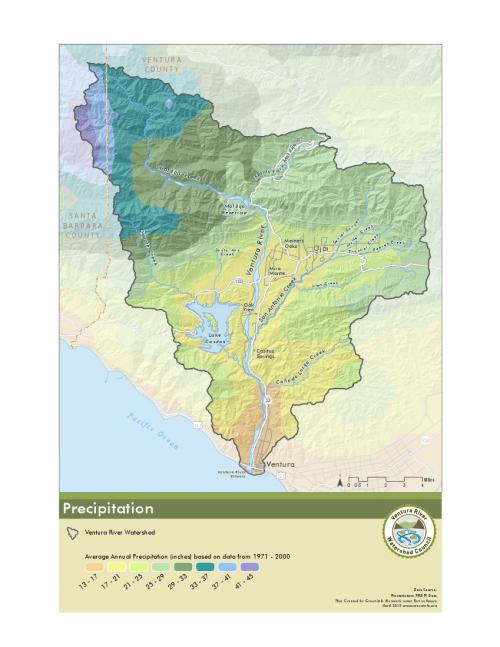
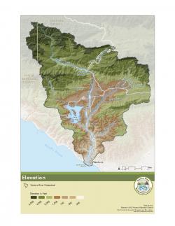
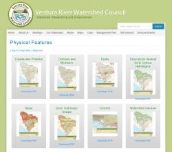
The Ventura River Watershed Council came to GreenInfo with a long wishlist of maps but a modest budget. GreenInfo worked closely with the organization to focus on key priorities and develop a suite of over 40 individual maps that met their needs. The maps have a brand identity that fits the Council's look and feel, and that is flexible for future maps.
The over 40 maps created cover physical features, water quality and supply, ecosystem factors and demographics. An extensive atlas of the maps is available with downloads on the VRWC web site. The project was described generally in a blog post in 2013.
GreenInfo also put together a simple interactive watershed viewer map.
Focus: Conservation, Environment
Services: Interactive Solutions, GIS Services, Maps, Cartography, Web Mapping
Tags: California, conservation planning, Esri ArcGIS, Ventura County, Water management, watershed
Project Years: 2013