See This Project | Similar Projects | All Projects for Client
Giving citizens powerful information on how to use recreational trails is more feasible than ever, thanks to advances in web mapping technology. But for this project in Cleveland, Ohio, GreenInfo was asked to stretch what was possible and developed innovative methods of letting users find and learn about trail opportunities.
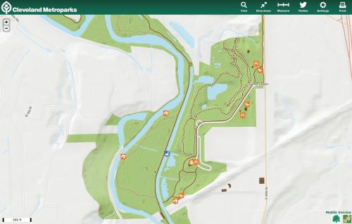
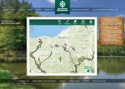
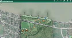
Cleveland Metroparks, with funding from Southwest General Hospital (http://www.swgeneral.com/), asked for a pair of web mapping apps allowing park visitors to find parks and park amenities. One app is a browser-based map of the parks and trails, and the other a mobile-app website.
This was GreenInfo Network's first full-scale mobile app, and it was quite a success. The website works on mobile devices from older smartphones to modern tablets, giving information and directions on parks, points of interest, trails. The site includes a chat function integrated with Twitter (#ClevelandParks), giving a degree of interaction "beyond the map" with other park visitors.
Results: The app launched in October 2012, and was an instant success. Park patrons are as pleased as the Cleveland Metroparks staff, at how easy it is to find points of interest and get directions to them.
Focus: Environment, Recreation
Services: Interactive Solutions, Web Mapping, Mobile Applications
Tags: Cleveland, Leaflet, Mapbox, mobile, Ohio, parks, Trail finder, trails
“ Just wanted to register my praise for GreenInfo and its staffer, Gregor-- his work to date has been splendid both in implementation and communication, a rare and enviable combination. I imagine this is something you've heard before, but I wanted to (semi-)formally add my praise to the pile.”
— Steve Mather, Geographic Information Systems (GIS) Manager, Cleveland Metroparks
Project Years: 2012