See This Project | Similar Projects | All Projects for Client
GreenInfo has developed the California Protected Areas Database (CPAD) over a nearly twenty year period. The data set now holds 15,000 parks and preserves owned by over 1,000 agencies/organizations, protected as permanent open space. A dozen key agencies and foundations have helped support this work.
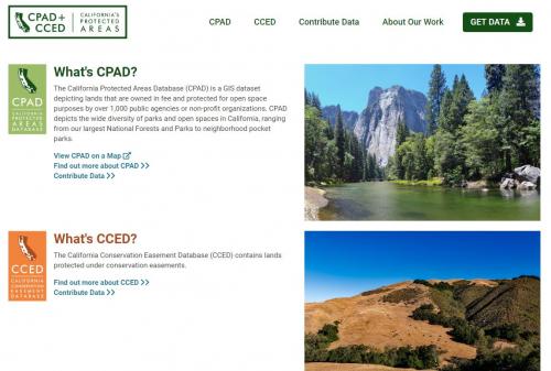
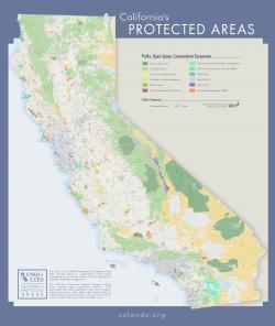
GreenInfo Network has developed the authoritative GIS database of all protected open space lands in California - over 49 million acres in over 55,000 separate holdings, owned by more than 900 public agencies and nonprofits. CPAD, the California Protected Areas Database, is now the most extensive state data set on protected lands in the United States.
CPAD began with work by Greenbelt Alliance to inventory parks and open space in the San Francisco Bay Area. In the late 1990s, GreenInfo turned that text database into GIS data, mapping out all the lands. In the late 1990s and through the first decade of the 2000s, GreenInfo broadened the database to cover all of California.
The inventory now ranges from small urban pocket parks to huge wildernesses, all mapped using the boundaries of official assessor ownership parcels. The main CPAD website, www.calands.org, enables download of the data, which is housed on the California GIS Data Portal. The CPAD data can also be viewed at www.ParkInfo.org, which helps anyone find parks, campgrounds and more in California.
Also in this system is a unique online application - MapCollaborator CPAD Edition, a web-based wiki that enables anyone to use interactive maps to pin notes or make drawings of improvements needed in the data.
Related to CPAD is the California Conservation Easement Database (CCED), which covers lands secured with easements, vs. fee ownership (tracked in CPAD).
Many public agencies and foundations have supported GreenInfo in the effort to get CPAD created and keep it up to date. These include the Calif. Strategic Growth Council, the Calif. Dept. Parks & Rec., the Calif. Coastal Conservancy, the Resources Legacy Fund, Bay Area Open Space Council, the Annenberg Foundation, PG&E, Sierra Nevada Conservancy and the Calif. Council of Land Trusts.
In early 2015, the State of California Natural Resources Agency renewed funding of CPAD updates and improvements for a two year period. A previous major project supported by the California Strategic Growth Council in collaboration with the USGS Gap Analysis Program had supported major CPAD improvements during the late 2012 to mid 2014 period.
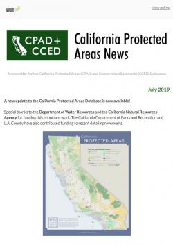
Work on CPAD and CCED was funded from 2018 through 2020 by the California Natural Resources Agency and the California Department of Water Resources. Thanks to this generous support, GreenInfo Network can keep these important datasets up to date, responsive to user needs, and representative of best practices for open data.
Results: The California Protected Areas Database (CPAD) has become one of the most-downloaded data sets in California. It is widely used by many agencies and organizations for analysis and display mapping and has become the California component in the national Protected Areas Database of the U.S. (PAD-US), published by the USGS Gap Analysis Program.
Focus: Conservation, Environment, Government Agencies
Services: Interactive Solutions, GIS Services, Data, Web Mapping
Tags: CPAD, Esri ArcGIS, GIS data, national forests, parks, Protected Areas, regional parks, Wilderness, wildlife refuges
Project Years: 2008-current