See This Project | Similar Projects | All Projects for Client
The Conservation Lands Network is the culmination of five years of detailed conservation planning led by the Bay Area Open Space Council's San Francisco Bay Area Upland Habitat Goals Project. GreenInfo worked closely on the project GIS data and mapping elements.
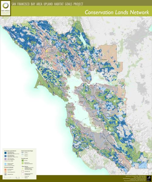
The Bay Area Open Space Council's San Francisco Bay Area Upland Habitat Goals Project launched the Conservation Lands Network as a five-year science-based study by over 125 organizations and individuals tasked to identify the most essential lands needed to sustain biological diversity. The study was designed to recommend the types, amounts and distribution of conservation lands as well as actions needed to sustain diverse and healthy communities of plant, fish and wildlife resources in the nine county Bay Area.
GreenInfo worked closely with the Council in compiling and analyzing huge amounts of GIS data on biodiversity, and then created a basic map frame and generated many poster and other sized maps for the project, including a version for their printed project report - many are available at the Network web site.
A separate GreenInfo project developed an interactive Conservation Lands Network Explorer web map application.
Focus: Conservation
Services: GIS Services, Data, Maps, Cartography
Tags: biodiversity, Esri ArcGIS, San Francisco Bay Area
Project Years: 2006-2011