Similar Projects | All Projects for Client
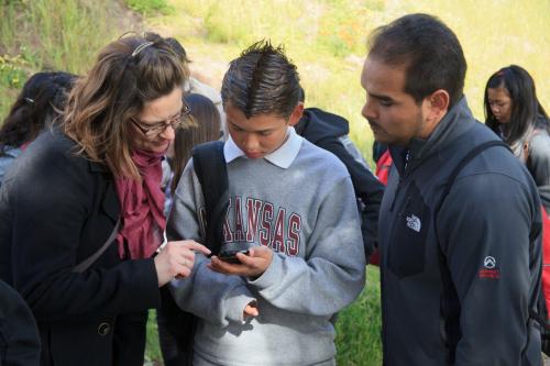
Every year, the Randall Museum near San Francisco puts on a Geography of Wetlands event in collaboration with the U.S. Geological Survey. For technical support with hands on GPS and other mapping, they turned to GreenInfo Network.
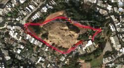
GreenInfo staffers helped out with the annual Geography of Wetlands event at the Randall Museum in San Francisco co sponsored by the USGS. Over two days, groups of middle schoolers came to the museum to learn about wetlands through hands-on activities. GreenInfo staff ran a session on mapping wetlands using GPS-enabled phones that were carried on short hikes. We used the phones to track our hike and create waypoints along the way, while discussing why GPS devices might be useful in the field when studying wetlands. After returning to the museum, the tracks were downloaded and we used Google Earth to display the route of the hike and explore other large wetlands on earth.
Focus: Education
Services: GIS Services, Training and Support
Tags: California, education, environment, USGS
Project Years: 2012