Similar Projects | All Projects for Client
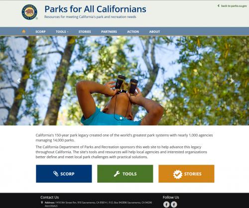
The usual approach for federally required state outdoor recreation plans is to publish a report and then reference it on a web site. California took a different approach, asking GreenInfo to build a web site that allows viewers to use interactive mapping tools to see park needs for any part of the state, as well as access other tools and information.
GreenInfo hosts the website, which is served through a custom domain, ParksForCalifornia.org, increasing flexibility in deploying the map and other interactive project tools. The front-end of the website was built using html, css, and Javascript in the Bootstrap framework, to be responsive on tablet and mobile devices while presenting a clean and modern interface.
The map tools were built using the tried and true open-source mapping stack consisting of Mapserver, PostgreSQL/PostGIS, and the CodeIgniter PHP MVC framework, with Leaflet/Javascript and jQuery powering the maps on the front-end. This combination enables interactive layer display on maps, prompt production of demographic summaries for user defined areas, as well as responsive charts and tables, and custom pdf report printouts based on search results.
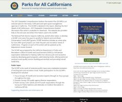
- Access to the SCORP document
- Interactive tools including information on park access, community attributes, and grant tracking
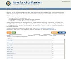
- A full inventory of the 1,000 agencies and nonprofits that manage California's 14,000 parks
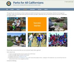
- Stories describing best practices for developing and improving parks
- An action plan to be taken to implement the SCORP
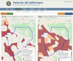
1. Measures of PARK ACCESS:
- The areas and estimated population living over a half mile from any park (standard established in the 1960 California Public Outdoor Recreation Plan)
- Underserved communities - census tracts with less than 3 acres of parkland per 1,000 residents (per legislation passed in 2008 enacted the Statewide Park Program, Public Resources Code §5642)
3. Over 8,300 grants totaling more than $2 billion dollars are detailed in the GRANT ALLOCATIONS tool. Each grant details the: grant program, total funds dispersed, project description, and location. A dynamic chart reports the total number of grants given by program and total funds administered.
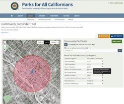
Each of the tools includes:
- A downloadable PDF report for offline use
- Downloadable GIS data sets used in the SCORP report and online, allowing GIS users to conduct their own analysis
- Detailed documentation of data definitions, sources, and methods
Results:
Focus: Environment, Government Agencies, Recreation, Social Justice/Equity
Services: Interactive Solutions, GIS Services, Analysis, Data, Maps, Web Mapping, Website Design
Tags: California, FactFinder, park access, parks, SCORP
Project Years: 2014-15