Similar Projects | All Projects for Client
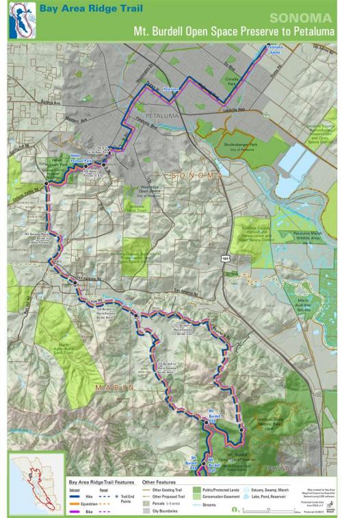
GreenInfo has long worked with the Bay Area Ridge Trail Council, providing mapping to help it complete its proposed 500+ mile regional trail system. In closing trail "gaps", highly detailed maps are needed, but because they are information rich, better cartography was needed, requiring special map design techniques.
Since the trail follows ridge lines, the topography of the land is very important to be prominent in the maps. However, the aerial is also an important feature. To allow the hillshading to come through only the vegetation and water features of the aerials are shown. To aid the Council with various different needs multiple layers were added to the map which was exported to a multilayered PDF. The Council staff can then turn on and off layers in the PDF as they chose.
Focus: Environment
Services: GIS Services, Maps, Cartography
Tags: California, cartography, Esri ArcGIS, Ridge Trail, San Francisco Bay Area, trails
Project Years: 2012 - current