Similar Projects | All Projects for Client
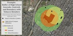
Accurately assessing public health and other factors around K-12 schools often requires knowing the boundaries of schools, not just a point location. Stanford's PRC and GreenInfo Network partnered to develop such a statewide dataset for the state of California.
Stanford's Prevention Research Center (PRC) has worked for some years on research around public health challenges near K-12 schools and sought out GreenInfo Network as a partner in completing a statewide inventory of actual campus boundaries for California. This work is currently in-process, with boundaries complete for over 7,000 of the state's 10,000+ schools - boundaries that are mostly mapped to assessor parcel lines.
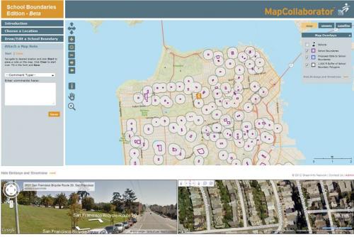
GreenInfo used traditional GIS tools, but also employed its innovative MapCollaborator web application. MapCollaborator allows users with no GIS background to create GIS data, review existing data, and make comments. Users can even upload GIS datasets for reference and comparison. The application also allows for detailed aerial and oblique photo views of a site.
Focus: Education, Government Agencies
Services: Interactive Solutions, GIS Services, Analysis, Data, Web Mapping
Tags: education, Esri ArcGIS, mapcollaborator, schools
Project Years: 2012-current