See This Project | Similar Projects | All Projects for Client
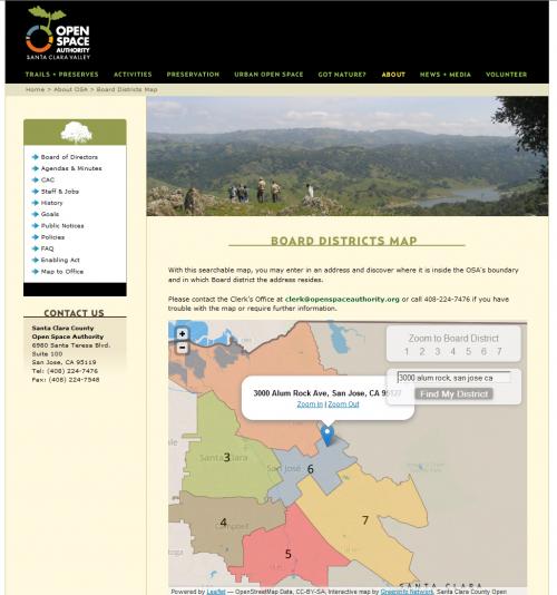
Boards of elected special districts and general purpose governments - or even nonprofits - can benefit by allowing their constituents to easily learn the district within which they live. The Santa Clara County Open Space Authority asked GreenInfo to build a simple web map application to do just that.
Voters in defined legislative districts sometimes need an easy way to figure out the name of their elected official. The Santa Clara County Open Space Authority's mission is "to preserve key portions of the natural environment in order to balance continuing urban growth. Buying land, acquiring easements, contributing funds to joint conservation efforts, and careful land management are OSA’s major preservation tools."
GreenInfo developed the online district finder map using TileMill for creating and styling the board districts. We used the Leaflet JavaScript API to develop the interactive map.
This type of district finder can be developed for most any organization that wishes to provide the same kind of location function - contact GreenInfo, if you'd like to learn more about how we can develop a similar application for you.
Focus: Conservation, Government Agencies
Services: Interactive Solutions, Web Mapping
Tags: Leaflet, legislative districts, Santa Clara County
Project Years: 2012-2013