Similar Projects | All Projects for Client
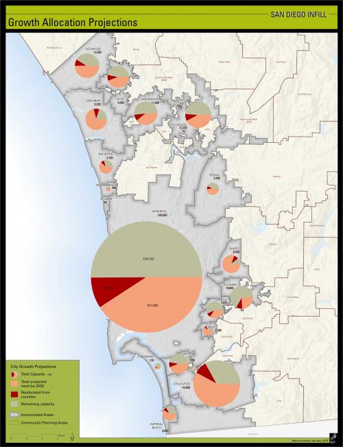
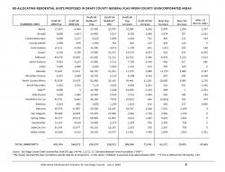
The Cleveland National Forest Foundation (CNNF) is an active participant in the debate over the future of San Diego County, California. In their attempts to better engage the County and the regional planning agency, SANDAG, CNNF asked GreenInfo Network to review county GIS and planning data and clarify the infill development opportunities.
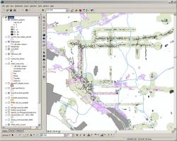
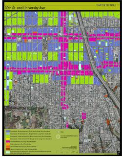
GreenInfo staff reviewed GIS data files and a number of studies complied by SANDAG and the County itself (which only manages land use on unincorporated lands). Because SANDAG had done excellent research at the ownership parcel level, GreenInfo was able to quickly pull together analysis that looked at the potential infill options, particularly in relation to a pending County General Plan amendment that proposed little focus on infill and more rural sprawl. Illustration maps were also created and a final report was prepared explaining the methods and findings. The report has been used to shape CNNF's public education and as a key element in pending lawsuit against the plans, alleging that they have not well enough considered transit-based land use alternatives. GreenInfo also advised CNNF on how best to present this information, and conducted followup mapping on specific infill opportunities.
Focus: Environment, Government Agencies
Services: GIS Services, Analysis, Maps
Tags: California, Esri ArcGIS, infill, San Diego, smart growth, sprawl
Project Years: 2010