See This Project | Similar Projects | All Projects for Client
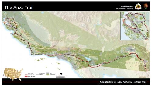
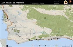
The National Park Service awarded GreenInfo a grant in 2012 to help it improve public understanding of the 1,200 mile Anza Historic Trail, which the service administers. The overall project involved building a website, creating an interactive trail planning tool - and a lot of GIS-based mapping.
GreenInfo Network started the mapping for the project by compiling extensive libraries of existing National Park Service and other geo-information into a large data catalog, covering over 20 counties along the thousand+ mile length of the corridor.
GIS specialists at GreenInfo then developed a cartographic model for county and other types of trail maps. This design adapted the "unigrid" formatting of the National Park Service, but refined it and added GreenInfo's own brand of visual thinking to the map features.
The result was a series of county, regional and whole-expedition maps that established a coherent and clear brand for the trail. These maps have also been integrated in the public website for the Anza Trail, which GreenInfo developed as part of this overall project.
Results: This project completed in early 2013.
Focus: Environment, Government Agencies
Services: GIS Services, Data, Maps, Cartography
Tags: Anza, Esri ArcGIS, National Park Service, NPS, trails
Project Years: 2011-2013