Similar Projects | All Projects for Client
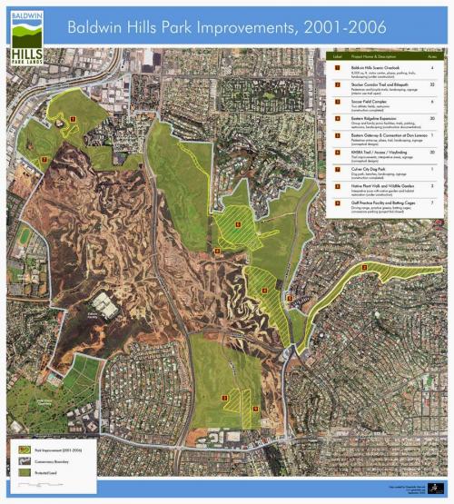
The Baldwin Hills Conservancy protects and enhances open space in a specific, high need area of western Los Angeles, California. The Conservancy has worked regularly with GreenInfo on mapping needs, including this poster map showing its key activities over a five year span.
As the Conservancy works to convert the last large open space in urban Los Angeles (most of it a former natural gas drilling site) to a park they have used maps to inform their board about progress on projects. This poster map allows viewers to clearly see the 9 specific projects accomplished over five years and the patterns of improvement and sections of the land that still need work.
Focus: Conservation, Government Agencies
Services: GIS Services, Maps
Tags: California, Esri ArcGIS
Project Years: 2006