Similar Projects | All Projects for Client
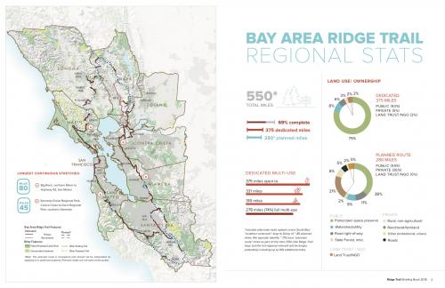
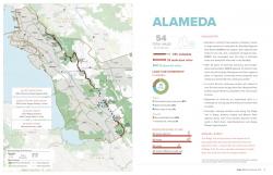
For almost two decades, GreenInfo has developed a wide range of map products for the Bay Area Ridge Trail, a 550-mile ridgetop loop around the San Francisco Bay. For a major Partner Summit in June 2018, we developed several large posters and regional and county detail maps for each county the trail passes through.
Completing the Ridge Trail is a massive and long-term effort involving a wide array of land managing partners and other stakeholders. The posters and briefing book maps we developed, along with graphic design and charts developed by the Ridge Trail's designer, helped give a common frame of reference that's both broad and focused.
The posters and briefing book cover each county, giving the full sweep of the effort, but summit participants could also focus on key metric through our consistent, clear cartography paired with highlight numbers for miles of trail dedicated and percent complete.
The maps and book also have value well beyond the summit itself, serving as a compelling call to action for fulfilling the vision of a complete and publicly accessible Ridge Trail for all to enjoy.
Focus: Recreation
Services: GIS Services, Maps
Tags: Esri ArcGIS
Project Years: 2018