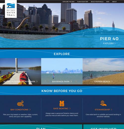
Over the past decade hundreds of "water trails" have emerged across the U.S. and elsewhere, spurred by a surge of participation in sea kayaking, canoeing, standup paddle boarding, and other water sports. Around San Francisco, the Bay is the heart of the region and a focus of a whole range of water sports, from calm canoeing on remote sloughs to acrobatic sailboarding right offshore from major urban areas. To help knit all this activity together, the San Francisco Bay Water Trail asked GreenInfo Network to totally overhaul the look and feel of its website and print maps.
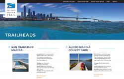
The Bay Water Trail is a network of dozens of Trailheads where the public can access the Bay and launch kayaks, paddle boards, and other nonmotorized craft. This project brought together every aspect of our print and web teams to develop a comprehensive experience that makes the best of both mediums.
On the web, at
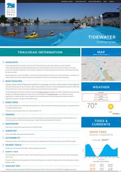
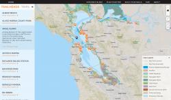
sfbaywatertrail.org, we present a rich visual experience with a full database of all the Trailheads and a select group of Trips created by Water Trail staff. On each Trailhead and Trip page, we bring in live weather forecasts and a custom-built interactive system that draws on live tide and current data from the National Oceanic and Atmospheric Association. We developed a custom, Bay-focused base map using Mapbox Studio to ensure that key information, like shipping lanes and danger zones, is always front and center. This is one case where a standard base map made largely for car travel just would not do.
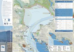
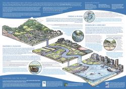
The web cartography was drawn almost entirely form the set of five print maps we created to cover the region. Those maps, printed on waterproof and tear-proof paper, include an incredible variety of information, including information tables about the amenities at each trailhead on the map. On the backside of the map, a custom illustration dives deep into the ecology and history of the Bay, from its sources inland all the way to the ocean.
The print maps were developed using ArcMap, then exported into Illustrator for preparation to be printed on large scale offset presses. The website is built in Wordpress, with full editability of all content and map location points and trips by Water Trail staff. We incorporated custom Javascript code to allow the map, weather, tides, and currents information to live alongside native Wordpress content.
Focus: Conservation,
Environment,
Government Agencies,
Recreation
Services: Interactive Solutions, GIS Services, Communications, Graphic Design, Publications, Maps, Cartography, Applications Development, Web Mapping, Website Design, Mobile Applications
Tags: Esri ArcGIS,
Mapbox,
San Francisco Bay Area,
Trail finder,
trails,
Wordpress
Project Years: 2017