Similar Projects | All Projects for Client
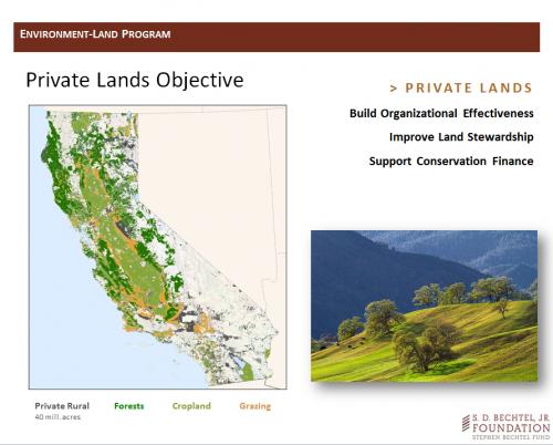
The Bechtel Foundation's Environment/Land Program wanted to brief the foundation's trustees on program goals and directions and asked GreenInfo to develop a presentation framework, for this use and for ongoing use.
GreenInfo worked with the program officer at the foundation to refine an overall message and a sequence of learning steps. We then developed a graphic style using the foundation's overall PowerPoint template and built slides to illustrate key points. Part of this work also involved creating maps that could be used in the presentation and for general use as posters and images. The presentation balanced a fairly complex program framework with simple, clear graphics and text, to support the the program officer's more detailed spoken presentation.
Focus: Conservation, Environment, Philanthropy
Services: GIS Services, Communications, Presentations, Maps
Tags: Bechtel, Esri ArcGIS, foundation, PowerPoint
Project Years: 2012