Similar Projects | All Projects for Client
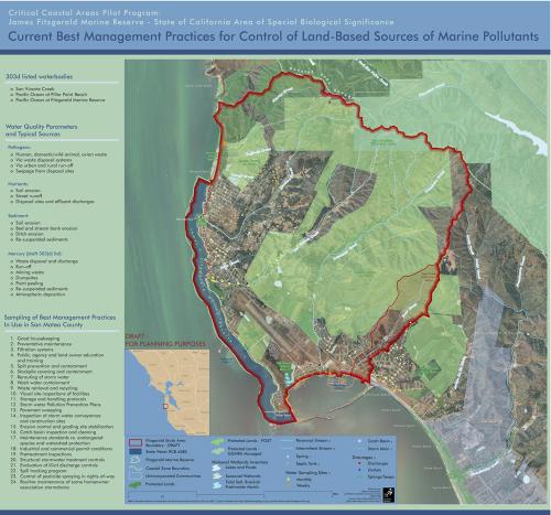
Created to aid detailed planning work in California's Areas of Special Biological Significance, this poster size map shows how extensive amounts of data can be made legible for workshops, presentations and other events.
GreenInfo staff assembled large data sets to portray on this planning map and developed very careful cartography to ensure that it was clear to viewers. The Association of Bay Area Governments (ABAG) commissioned this map for use in a pilot project in coastal San Mateo County.
Focus: Environment, Government Agencies
Services: GIS Services, Maps
Tags: Esri ArcGIS, pollution, Water management, water quality
Project Years: 2009