Cool Green - Healthy Greening and Stormwater Opportunities for the Birmingham, Alabama Area

Title page of Story Map, downtown Burmingham
Client:   The Nature Conservancy in Alabama and Partners

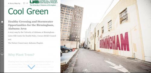
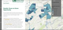
In collaboration with The Nature Conservancy’s Alabama chapter and University of Alabama at Birmingham - Lister Hill Center for Health Policy, we built an ArcGIS StoryMap focused on Urban Reforestation and Stormwater Opportunities for the Birmingham, Alabama Area.

The StoryMap highlights the benefit of planting trees through its interactive maps showcasing the reduction in urban heat island effects, reduction in flooding, and improved air quality. Our study area focuses on the EPA EnviroAtlas Birmingham Community – including 56 cities in Jefferson and Shelby County, 577 census block groups. The Birmingham study area is 146 square miles of land with a population of 209,8880 (2018).The metrics under analysis per census block group include the percentage of tree canopy cover, reduction in night time heat temperatures, percentage of impervious surface, reduction in annual runoff (m3/yr), percent of green spaces, FEMA Flood Hazard Zones, acute respiratory symptoms avoided (cases/yr) by reduction in ozone, and acute respiratory symptoms avoided (cases/yr) by reduction in fine particulate matter. The final interactive map identifies plantable spaces within areas that would benefit the most from trees.

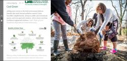
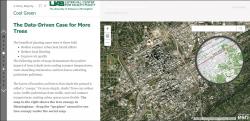
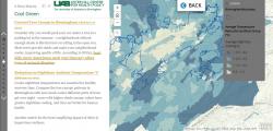
The study set out to prioritize places that need cooler temperatures in the summer, less stormwater flooding, and better air quality. We wanted to find opportunities for green infrastructure (GI). Green Infrastructure (GI) is a network of stormwater management practices, such as green roofs, trees, rain gardens, and permeable pavement, that can capture and infiltrate rain where it falls, to reduce stormwater runoff and improve the health of urban streams. GI practices can also positively impact energy consumption, air quality, carbon reduction and sequestration, property prices, recreation and other elements of community health and vitality. This Story Map is an entry point for the public, in the context of community meetings, to understand and be engaged in green infrastructure.

Focus:   Conservation, Social Justice/Equity  

Services:  Interactive Solutions, GIS Services, Communications, Graphic Design, Presentations, Cartography, Web Mapping 

Tags:   ArcGIS Pro, Esri Story Map  

Project Years: 2019, 2020

GreenInfo Network creates, analyzes, visualizes and communicates information in the public interest. We specialize in mapping and related technology for nonprofits and public agencies, focusing on using it for conservation, social equity, public health, environment and foundation grant making.
2201 Broadway, Suite M5
Oakland
CA
94612
United States of America