Similar Projects | All Projects for Client
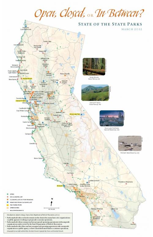
Budget difficulties in California had led to the threat of closing many State Parks. Bay Nature magazine asked GreenInfo to develop a centerfold map to highlight the park closures against the backdrop of the state's geography.
During 2011 and 2012, there was a substantial budget threat to California's state parks, with the prospect of scores of parks being closed for a year or more. Bay Nature had commission an article on the crisis and asked GreenInfo's Louis Jaffe to develop a map to illustrate the situation. The resulting map uses a simple graphic design, but contains complex visual information about different types of parks and their closure status.
Focus: Environment
Services: GIS Services, Communications, Publications, Maps, Cartography
Tags: Bay Nature, California, parks
Project Years: 2012