See This Project | Similar Projects | All Projects for Client
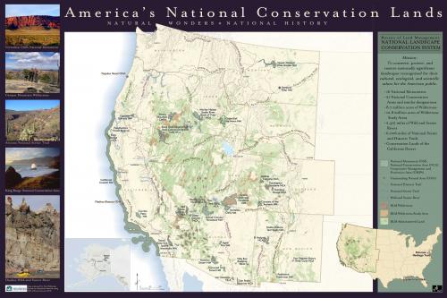
The Bureau of Land Management's National Conservation Lands, also known as the National Landscape Conservation System, contain some of the West’s most spectacular landscapes. To celebrate the 10th Anniversary of the designation of the National Conservation Lands program, The Wilderness Society asked GreenInfo Network to create a series of maps highlighting the accomplishments.
The National Conservation Lands include more than 887 federally recognized areas and approximately 27 million acres of National Monuments, National Conservation Areas, Wilderness Areas, Wilderness Study Areas, Wild and Scenic Rivers, National Scenic and Historic Trails, and Conservation Lands of the California Desert.
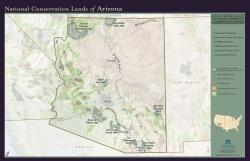
This mapping project resulted in a series of products that included a map of the west (where most of the Conservation Lands are), with a national inset showing the 2 areas designated on the east coast. The series also included a map for each state in the west, complete with statistics for the program in that state.
Focus: Conservation, Environment
Services: GIS Services, Maps, Cartography
Tags: BLM, Esri ArcGIS, National Conservation Lands , Western United States, Wilderness
Project Years: 2010