See This Project | Similar Projects | All Projects for Client
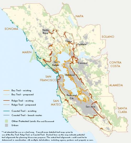
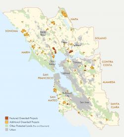
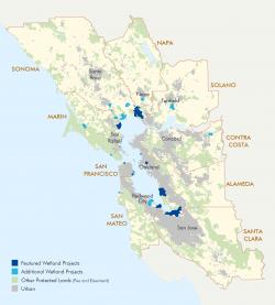
The Coastal Conservancy's Bay Area Program put together a report celebrating their 15th year of accomplishments and need a map illustrating their progress.
GreenInfo was asked to put together maps for the California Coastal Conservancy's report highlighting focus areas and accomplishments. The maps were developed in GIS and exported as image files for use in an offset printed publication.
Focus: Conservation
Services: GIS Services, Maps
Tags: coast, Esri ArcGIS, parks, San Francisco Bay Area, Wetlands
Project Years: 2012