See This Project | Similar Projects | All Projects for Client
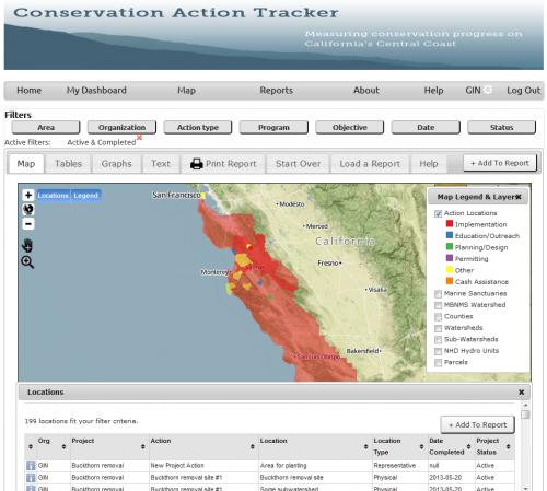
The Central Coast Conservation Action Tracker (CCAT) is a web portal, enabling member organizations to post projects which affecting water conservation and water quality in their area. The goal of CCAT is to foster coordination and cooperation between water-management and agencies, by making it easy for them to discover other organizations' projects of interest in nearby areas.
The Greater Monterey County Integrated Regional Water Management Plan (IRWMP) contracted with GreenInfo Network to create the Central Coast Conservation Action Tracker (CCAT). Logged-in members can post projects and project actions pertaining to water conservation and water quality, and can view others' projects. The goal of CCAT is to encourage cooperation and coordination between member organizations.
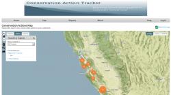
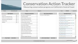
For CCAT members, an advanced interface allows for customized reports, filtering by several criteria and generating charts, spreadsheets, and summaries of relevant projects. The general public may use the simplified version of this interface, viewing information on projects of interest and generating a simplified PDF report.
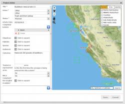
Of technical interest are a relational database and a flexible and secure access control model. Projects are "owned" by an organization, and contain a nested hierarchy of project actions, locations of actions, funding information, outcomes and goals of both actions and projects, hyperlinks and photos, and more. The resulting hierarchy is large, but smoothly designed and well documented. Projects may be shown or hidden based on a simple yet flexible "sharing" setting: a project may be tagged as visible to the public, visible only logged-in to CCAT members, or visible only to other users within the same organization, and security-conscious programming practices ensure that clever users cannot bypass these sharing restrictions.
Focus: Conservation, Environment, Government Agencies, Public Health
Services: Interactive Solutions, GIS Services, Communications, Strategy, Analysis, Data, Maps, Training and Support, Applications Development, Web Mapping, Website Design
Tags: collaboration, IRWMP, Mapbox, OpenLayers, PDF printing, pollution, Water management, watershed
Project Years: 2013-2014