See This Project | Similar Projects | All Projects for Client
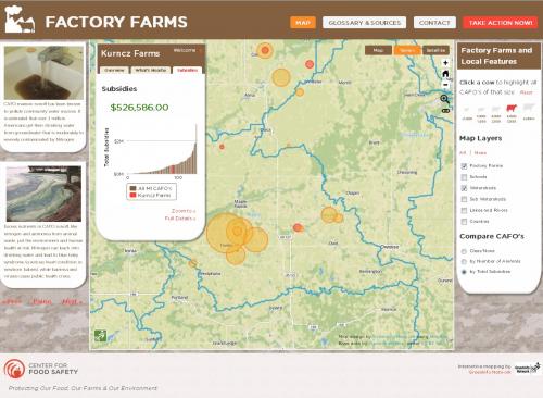
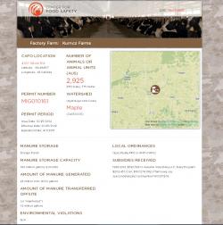
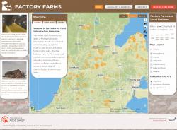
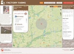
The Center for Food Safety's mission is to balance food production with public health. They asked GreenInfo to develop a web mapping application to visualize and explore the impacts of factory farms in Michigan.
Using open source mapping and web technologies, GreenInfo designed and developed an intuitive and engaging map interface for sharing information about factory farms (Concentrated Animal Feeding Operations - or CAFOs) and their impact on the environment and people around them. The site blends design and functionality in an extensible way that can be applied to mapping CAFOs and related features in other locations.
As of early 2016, this site is offline while the Center for Food Safety develops updated information - learn more on their web site.
Results: Dynamic, interactive web map of CAFO locations and associated information.
Focus: Environment, Public Health
Services: Interactive Solutions, GIS Services, Data, Applications Development, Web Mapping, Website Design
Tags: factory farms, farming, Michigan
Project Years: 2013-2014