Similar Projects | All Projects for Client
We often work closely with Warner Chabot, an independent environmental consultant on public policy issues, working to protect and improving the health of our communities and environment
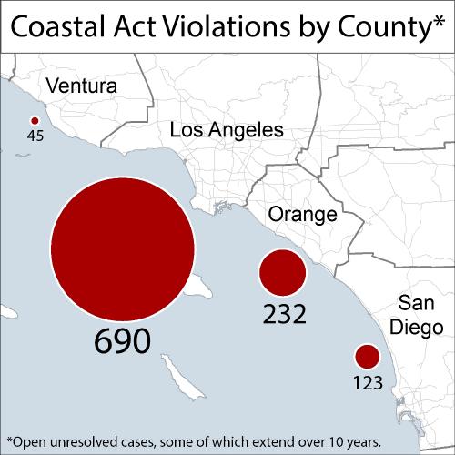
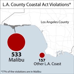
For this quick mapping project, we focused on Coastal Act Violations throughout Southern California and in Los Angeles County. Warner Chabot used these maps to address the issue of violations and he was successful in getting an LA Times editorial published and helping the California State Senate pass a bill about this issue.
Focus: Conservation
Services: GIS Services, Maps
Tags: California, coast, Esri ArcGIS
“ You have no idea how helpful your maps have been -they just electrified this campaign!!! Huge thanks.”
— Warner Chabot, Consultant
Project Years: 2013