See This Project | Similar Projects | All Projects for Client
Community clinics and health centers are vital elements in delivering health care services to California residents. The statewide association of these nonprofits asked GreenInfo to help them with better mapping.
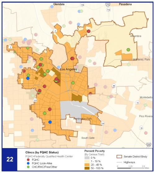
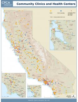
California Primary Care Association (CPCA) is the statewide voice for the interests of more than 800 California non-profit community clinics and health centers and their patients. CPCA asked GreenInfo to develop a series of maps to help them better explain the relevance of clinics and to support better internal planning. GreenInfo developed several statewide maps of clinics and health centers, for use at poster and page size. We also prepared an "atlas" of maps by California legislative district, showing the clinics in each district along with related information - this was used in meetings with legislators to inform them about clinics that they represented.
Focus: Human Services, Public Health
Services: GIS Services, Data, Maps, Cartography
Tags: California, Clinics, Esri ArcGIS, Health, Public Health
Project Years: 2008