See This Project | Similar Projects | All Projects for Client
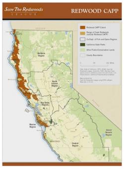
Save the Redwoods League (SRL) worked with GreenInfo Network to create an updated Conceptual Area Protection Plan (CAPP) using over a dozen detail spatial data sets. Watersheds and individual parcels were evaluated using extensive modeling to prioritize lands of high importance for protection.
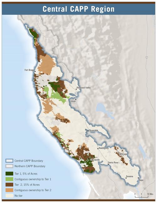
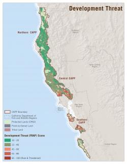
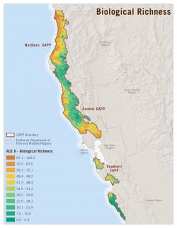
Starting in 2012, GreenInfo Network worked with SRL to create an updated CAPP for their region, one of the largest such plans ever created in California. The complex GIS analysis evaluated: existing open space, mature redwood forest, young redwood forest, fish/bird/mammal habitat, development, road density, and soil diversity. Multiple models were developed to rank the relative priority for individual parcels and watersheds.
The resulting report was submitted to the California Dept. of Fish & Wildlife, which has approval responsibility.
Results: The results of the project illustrate key areas SRL will work to protect in the future. The maps and data were submitted in 2013 and should be finalized in 2014.
Focus: Conservation, Environment
Services: GIS Services, Analysis, Data, Maps
Tags: biodiversity, California, CAPP, conservation planning, CPAD, environment, Esri ArcGIS, habitat, parcelization, Protected Areas, Redwoods, stewardship
“ GreenInfo worked closely with me throughout the process. They were responsive and timely, and our project finished under budget and over expectations!”
— Richard Campbell, Conservation Science Manager
Project Years: 2012, 2013, 2014