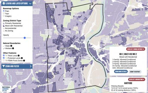
The National Zoning Atlas aims to digitize, demystify, and democratize information currently hidden within U.S. zoning codes across the country. Zoning laws dictate much of what can be built in communities across the United States. The National Zoning Atlas crowdsources these incredibly influential laws by depicting their key attributes in an online, user-friendly map.
In the Fall of 2022, the Zoning Atlas was operating within Cornell University, who sought out a vendor to develop a full-stack web application to support the National Zoning Atlas. The goal was to replace the current manual process using Google Sheets and file sharing services like Dropbox to create a more streamlined system.
The project already had extensive documentation and specifications, so our job was to turn the manual shapefile and spreadsheet process into a modern web application.
Using an open-source stack built on Azure, we deployed a web server and installed Django as a backend. Separately, we deployed an Azure Blob storage to store uploaded files and data, and an Azure Database to host the PostgreSQL instance.
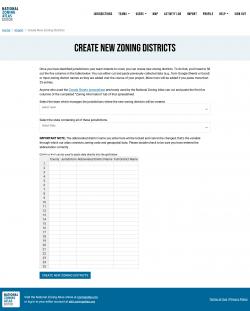
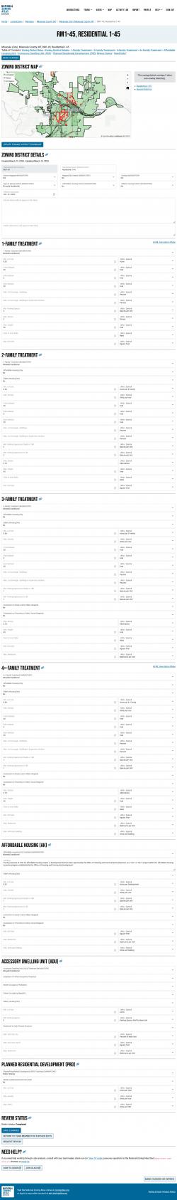
Using accessibility best practices, and using the Bootstrap 5 framework, we built a series of pages for viewing, uploading, importing, and editing jurisdictions and zoning districts. For pre-loading data, we used Handsontable to give users an easy way to paste the zoning and jurisdiction data they discovered in their research.
Results: The National Zoning Atlas's roots lie in 2020 when Professor Bronin developed the methodology that created the Connecticut Atlas. Today, the project operates under the Land Use Atlas, Inc. nonprofit. As of 2024, a diverse set of over 400 people have contributed to the data in the atlas.
Focus: Economic Development,
Environment,
Government Agencies,
Public Health,
Social Justice/Equity
Services: Interactive Solutions, Applications Development, Web Mapping, Website Design
Project Years: 2022,2023,2024