See This Project | Similar Projects | All Projects for Client
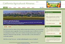
The explosion of interest in local agriculture has resulted in renewed focus on the availability of fresh, nearby produce and other farm products. SAGE, an innovative educational organization, developed the idea of an online almanac to support better information about farms, produce and people, then turned to GreenInfo to develop and implement that concept.
California has one of the most diverse and extensive specialty crop bases in the world - over 150 fruits, nuts and vegetables are grown in the state. The soil and climate for farming are outstanding, stretching for over 800 miles north/south. Around these lands are over 36 million people, served by markets and educational events and opportunities.
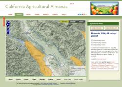
Putting all this information together was the vision of SAGE, which focuses on education about sustainable agriculture. SAGE asked GreenInfo to help assemble the data, and then design and implement a web site that could showcase specialty crops - a concept that had to be balanced by the information that was actually available. GreenInfo worked early on with SAGE to determine a taxonomy of agricultural places -recognizable growth areas - and assess how crop information might be defined for these areas.
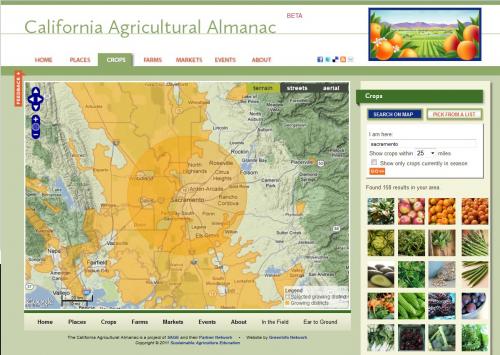
Using a combination of local knowledge, statewide cropland data and national crop inventories, we developed GIS data on the geography of specialty crops. This work was aided by a custom web interface that allowed SAGE staff to refine much of the data themselves.
Web design began with wireframes to determine the best functions for an "agricultural atlas", coupled with further research into data on farms, farmers markets and educational events. SAGE developed partnerships with various allied organizations that resulted in datasharing to place this information into the site. Development versions of the site were used to test out and then rework as needed the kinds of search and discovery that were possible and needed.
The full web site was then built with graphic design assistance from Ison Design. Included in the site are functions to search by place (address, zip code, county) or by crop, and to overlay all farmers markets in California and see event feeds from groups doing educational tours and classes. Many mapping features were also added to the site which went live in late 2011.
Focus: Environment
Services: Interactive Solutions, Applications Development, Web Mapping
Tags: agriculture, California, crops, farmers market, farming, OpenLayers, SAGE
Project Years: 2011