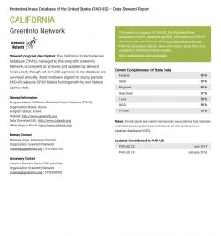
GreenInfo has long supported the USGS Protected Areas Database of the United States (PAD-US), the official GIS inventory of America's public parks and other preserves. One of the key elements in PAD-US is its system of relying on data stewards to submit federal agency and statewide data. As part of a series of improvements to PAD-US, the USGS team asked Greeninfo to develop a more efficient tracking system for this data flow.
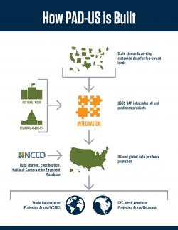
PAD-US relies upon four streams of data to develop a full national inventory of protected areas: 1) Federal agency land holdings; 2) state-by-state aggregations of state and local lands; 3) conservation easements from the
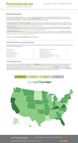
National Conservation Easement Database (NCED); and 4) national nonprofit land data. Each of these involves defining "data stewards" who collect GIS data on their own managed areas and (ideally) provide it to PAD-US in a format consistent with national standards. See the GreenInfo-developed image at left for how this system works.
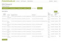
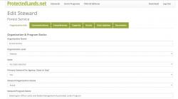
Until the system defined here came online, the PAD-US staff tracked these in series of online spreadsheets - some of those sheets in turn provided input data to the
steward mapping on the PAD-US companion site, www.ProtectedLands.net, developed and maintained by GreenInfo Network. To improve this system, USGS needed a more robust way to document both the data flows that go into each PAD-US edition, as well as to better manage its contacts with each steward organization.
After preparing general wireframe concepts to test what USGS needed, GreenInfo web developers created an online database in Python, using the Django framework, with a MySQL back-end. This was then styled into a user-friendly interface with a log-in system (the database itself is not public, but serves data out to various public web applications).
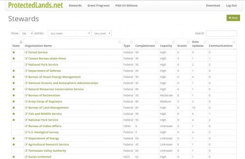
The ProtectedLands.net visualization of data stewards was then re-wired to be created from the daatabase, and certain elements were expanded in the process. You can browse all this from the project link,
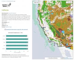
http://www.protectedlands.net/data-stewards/ - click on any federal agency listed, or on the states in the map at the bottom for detailed information. By early 2018, most of the old data managed by text documents will be transferred into this online system.
Overall, this project is a great example of how GreenInfo's deep expertise in protected areas data can combine with highly efficient web application development to help a client move far ahead in their overall program efficiency.