See This Project | Similar Projects | All Projects for Client
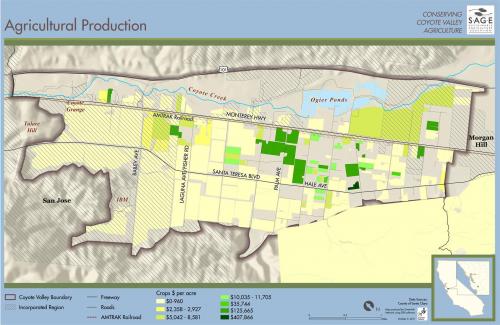
Agricultural parks are a new concept linking metropolitan planning and public health. SAGE was charged with developing a feasibility analysis for continued agriculture in a hotly-contested 7,400 acre valley near San Jose.
GIS analysis and mapping was used to investigate existing regulatory, physical conditions and current land uses in all regions of the Coyote Valley. Ultimately, the plan recommended the creation of the Coyote Valley Agricultural Enterprise and Conservation program (COVAEC). This program would develop multi-faceted systems to coordinate investments that optimize economic, environmental, and social returns while sustaining and enhancing agricultural and conservation activities in the Coyote Valley.
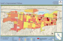
GreenInfo produced a series of tabloid and page sized maps for reports and for use in meetings. The maps were developed to show a common cartographic approach to each scale being used, and present often very detailed information.
Results: In 2013, the project was awarded a $250,000 to begin implementation of elements of the plan.
Focus: Conservation, Environment
Services: GIS Services, Data, Maps
Tags: agriculture, Esri ArcGIS, food, SAGE, San Francisco Bay Area
Project Years: 2011-2012