See This Project | Similar Projects | All Projects for Client
Creating a 500 mile regional trail system that covers public as well as private lands is an ambitious goal. The Bay Area Ridge Trail Council has worked with GreenInfo Network for over a decade to define the trail and track progress in implementing it, and to ensure that trail establishment and support projects are well organized and integrated with the GIS data.
The Bay Area Ridge Trail Council is dedicated to creating a continuous 550+-mile trail for hikers, mountain bicyclists, and equestrians along the ridgelines overlooking San Francisco Bay. The Council works in close partnership with agencies and local government, parks, land trusts, and other stakeholders and volunteers. Created in 1987, the Council has now overseen the dedication of 325 miles of the total trail system.
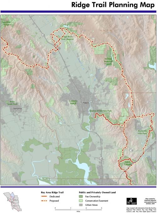
From its beginnings, maps have been crucial to the Council's efforts. In the early 2000s, the organization engaged GreenInfo Network to develop a comprehensive, computerized approach to the trail and associated project data. The first major task in GreenInfo's work was to digitize all the trail segments, existing and planned, linking them to a complex set of attributes. GIS software and careful definition of the location of the trail in relation to existing parks and boundary and topographical features created an extensive set of segments, each with an identification number.
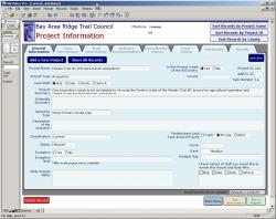
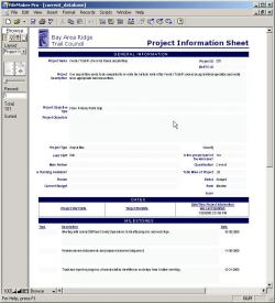
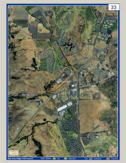
GreenInfo staff then developed a very detailed database for managing information about the segments and projects that relate to them. Using FileMaker software and employing over 100 fields in several related tables, an application was created that enabled Ridge Trail staff to quickly scan through data entry and standard and customized reporting. For example, reports could be easily created by congressional or legislative districts of progress and projects. A page size atlas of over 100 pages was also developed, showing the trail by status over aerial photographs and parcel lines. This allowed Ridge Trail staff to go to any meeting or field session and have useful details readily available. More extensive mapping was also developed, from regional posters to smaller, focused maps.
This system has been in use for almost a decade and has been refined several times along the way. A 2012 mapping update is focused on a new set of cartographic standards and conventions, while numerous improvements have been made in the base trail alignment data.
Focus: Environment
Services: GIS Services, Data, Maps
Tags: atlas, Bay Area, California, Esri ArcGIS, Ridge Trail, trails
Project Years: 1999 - current