Similar Projects | All Projects for Client
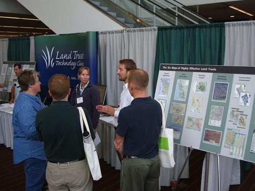
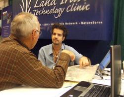
The Land Trust Alliance's National Rallies draw upwards of 2,000 land trust representatives annually. GreenInfo worked with the Alliance to provide a special "doctor's office" booth, to aid in answering questions about GIS.
GreenInfo has long supported land trusts with mapping and information technology. Being able to have staff present at several of the Land Trust Alliance national rallies was exciting for us, as we could better connect directly with people from all over the country and share what we've learned about using GIS for land trusts - as well as learn from those same land trusts!
The clinic included two GreenInfo GIS staff, plus two-three other GIS experts and one representative from Esri, the publisher of ArcGIS software. Scores of people visited the booth over each of three rallies.
In addition, GreenInfo has led a popular, 90 minute workshop at each of the past four rallies on what's happening with GIS, with sold-out attendance.
Focus: Conservation
Services: GIS Services, Training and Support
Tags: Esri ArcGIS, land trust
Project Years: 2007-current