
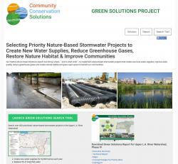
Similar Projects | All Projects for Client
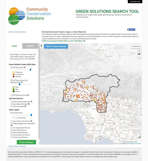
Growing population makes for challenges in the management of California's water supply. Recent state legislation (and common sense!) emphasize strategies that allow for storm water to drain into the ground and be re-used for irrigation rather than being channeled into stormdrains and directed to our rivers and oceans. These "green solution" strategies can have dramatic effects on local water supplies, replenishing aquifers and reducing greenhouse gases from the energy needed to import water over long distances. Community Conservation Solutions (CCS) has been a leader in pushing for these approaches and asked GreenInfo Network to develop an online mapping application to help present their most recent work in the Los Angeles region.
To develop the Green Solutions mapper, the lead consultant, ESA, provided GreenInfo data for over 400 sites that had been identified and prioritized for implementation, including parks and various types of school properties.
GreenInfo's approach began with a review of target audiences and what they would need out of an online application. This profile was used in developing wireframes of the application. Data review was tested using ArcGIS, defining symbolization and looking for data overlap issues that might arise.
Using this design, GreenInfo web developers created a database system and a mapping framework, plus a user interface concept that provided both the ability to control map layers and the ability to search for sites. The final application features:
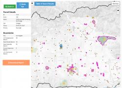
- Green Solutions sites as points and polygons, and grouped by several "best for" categories
- 7 layers of reference information (legislative districts, disadvantaged community areas, cities)
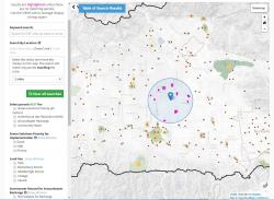
- Search functions - by site name/keywords, by user-drawn area (circle, polygon), by legislative district
- Search filters - 8 choices of types of green solutions parcels to focus in on
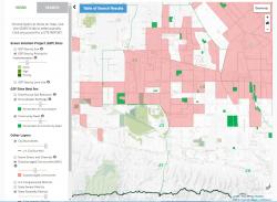
- Table view of search results, downloadable as a .csv (spreadsheet) file
- Data views for each site, including access to a site PDF report and a birds eye view in the mapper
We used wkhtmltoimage and wkhtmltopdf to create the application's PDF site reports. A PHP batch script dynamically renders the reports in HTML, then wkhtmltopdf renders the HTML to PDF for each site.
Focus: Environment, Government Agencies
Services: Interactive Solutions, GIS Services, Cartography, Applications Development, Web Mapping
Tags: Los Angeles, stormwater
Project Years: 2016