See This Project | Similar Projects | All Projects for Client
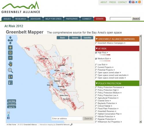
The Greenbelt Mapper is an interactive online map highlighting open space values, policy protection, and risks to the San Francisco Bay Area's greenbelt. Ever wonder if a particular wildlife habitat is in danger of sprawl development? The answer to that question and many more are just a click away.
Greenbelt Alliance's Greenbelt Mapper is an expert resource that allows users to see where development is planned on Bay Area land, where growth management measures are in place, and the values that specific open space lands provide.
GreenInfo developed the mapping application for Greenbelt Alliance, the Bay Area's urban planning and land conservation group. Greenbelt staff created extensive data and modeling strategies and GreenInfo staff developed the web application to enable users to view, select and query this extensive information.
Results: The Risk Mapper is considered by Greenbelt Alliance to be an essential element in its overall strategy to encourage city-centered development and discourage sprawl.
Focus: Conservation, Environment
Services: Interactive Solutions, GIS Services, Data, Applications Development, Web Mapping, Website Design
Tags: At Risk, Esri ArcGIS, sprawl, urban development, urban planning
Project Years: 2012