Similar Projects | All Projects for Client
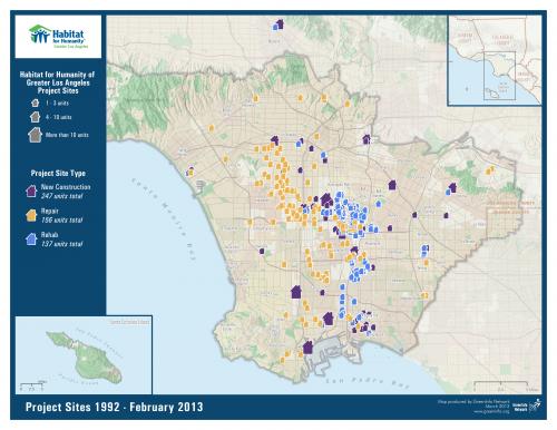
Since 1990 Habitat for Humanity of Greater Los Angeles has built or rehabilitated more than 450 houses across Los Angeles, and asked GreenInfo to create a current site map and index for all of these projects.
Habitat for Humanity of Greater Los Angeles works in one of the least affordable housing areas in the country. GreenInfo created for them a set of geographic data for their project site database and then designed a large poster display map of these project sites.
Focus: Human Services, Social Justice/Equity
Services: GIS Services, Data, Maps
Tags: California, Esri ArcGIS, housing, Los Angeles
Project Years: 2013