See This Project | All Projects for Client
The Illinois Sustainable Ag Partnership (ISAP) brings together diverse member organizations who work collaboratively to encourage adopting sustainable and profitable production practices that improve soil health and restore local waters.
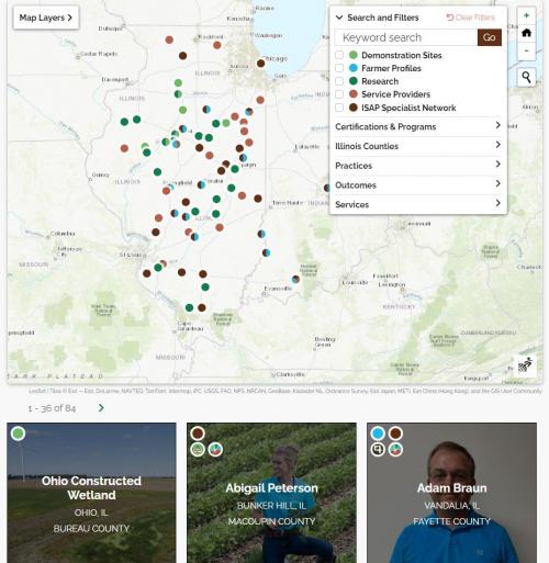
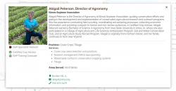
The purpose of the story map is to connect conservation professionals in Illinois to farmers, service providers, published research, and educational demonstration sites across the state.
The system has a Django backend, where admins have a login to manage the listing of all farms and ranches. There is a public-facing signup form with a profile photo crop and upload tool. Bootstrap and jQuery were used for frontend work to build a responsive iFrame and photo grid of farmers. We also built an iFrame resizer on the parent page.
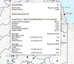
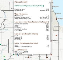
We used Mapserver for the tile layers and spatial queries. When a farm is submitted via the application, it does a spatial intersection to add location-specific attributes to the farm, like watershed (HUC4), Eco Region, and Plant Hardiness Zone attributes. We also used Leaflet to provide custom filters and controls in the map.
Focus: Conservation, Environment
Services: Interactive Solutions, Applications Development, Web Mapping
Project Years: 2022