See This Project | Similar Projects | All Projects for Client
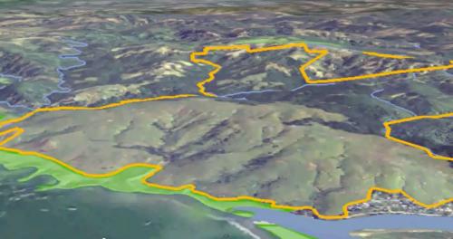
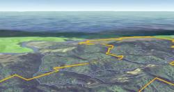
In 2009, GreenInfo worked with the Sonoma Land Trust on their campaign to conserve Jenner Headlands, a 5,630-acre property on California's North Central Coast, helping them with a virtual "tour" of the site.
We used Google Earth to overlay the boundaries of Jenner Headlands and to show rivers, streams, and surrounding protected lands. At the time, imagery in Google Earth had clouds showing in this particular area, so we overlaid clear, high resolution imagery. Using Google's Movie Maker function within Google Earth, we were able to export a fly-through that could then be integrated with actual video of the property.
Results: Jenner Headlands was conserved forever on December 17, 2009. Read more about the acquisition here - http://www.sonomalandtrust.org/protect/campaigns/jenner/jenner.html
Focus: Conservation
Services: Interactive Solutions, GIS Services, Data, Web Mapping
Tags: California, conserved lands, Google Earth, land trust, Sonoma County, YouTube
Project Years: 2009